Update Google Street View in New Orleans!
Saturday, May 3, 2014
Street View now lets you go back in time!
We didn't think we'd be updating this anymore, but when Google updated the New Orleans street view we still kinda wished there was a way that we could see the Katrina era pictures. But that wasn't something we thought they would ever prioritize, or that it was something all that many other people wanted.
When street view was updated we considered the mission of this blog met. Google has gone ahead and completed our secret secondary mission as well. While we're not really big fans of the "new" google maps interface-wise, this is awesome!
Tuesday, August 14, 2012
Google Street View in New Orleans: UPDATED!
It appears Google has just updated Street View in New Orleans with imagery from 2011!
The official post from the Google Lat Long blog is by our mayor Mitch:
Many thanks to NOLA Defender, Search Engine Land, and the individuals who all took time to contact Google PR (and to Rebecca for alerting us). And MAJOR thanks to Google for updating!
Most of all: thank you to all of the readers who sent us messages with your personal stories about trying to move back to New Orleans, about visiting New Orleans, about loving the beautiful architecture and colors of this city, and about recovery. Those were some of the best things to come out of this blog.
For fun, here's an updated version of our first post:
Thanks, all!
- Hunter and Annalisa
The official post from the Google Lat Long blog is by our mayor Mitch:
Nearly 7 years after Hurricane Katrina and the federal levee failures in 2005, the resilient people of New Orleans are making remarkable progress. The Street View imagery in Google Maps, which has just been updated today, more accurately reflects the major construction and renewal that’s underway. It’s everywhere you look, from the nearly 2-mile long, 26-foot-high Inner Harbor Navigation Canal (IHNC) Hurricane Protection Barrier to the major construction near downtown that will be the future site of two hospitals and a biomedical research corridor.
Many thanks to NOLA Defender, Search Engine Land, and the individuals who all took time to contact Google PR (and to Rebecca for alerting us). And MAJOR thanks to Google for updating!
Most of all: thank you to all of the readers who sent us messages with your personal stories about trying to move back to New Orleans, about visiting New Orleans, about loving the beautiful architecture and colors of this city, and about recovery. Those were some of the best things to come out of this blog.
For fun, here's an updated version of our first post:
 |
| Original Street View screenshot taken 6/20/2012, with Google imagery from 2007 |
 |
| Our photo taken 6/20/2012 |
 |
| NEW Google Street View screenshot taken today, 8/14/2012, with Google imagery from 2011. |
Thanks, all!
- Hunter and Annalisa
Monday, July 23, 2012
Deslonde & Dauphine (Lower Ninth Ward)
Wednesday, July 18, 2012
Tuesday, July 17, 2012
Deslonde & Burgundy (Lower Ninth Ward)
Monday, July 16, 2012
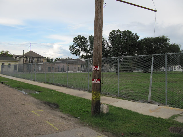
Ghosts of Demolition: Phillis Wheatley Elementary School
Plus a "now open" Willie Mae's.
"Historic Phillis Wheatley Elementary School torn down in Treme" - Times-Picayune, June 17, 2011
 |
| Google Image date: August 2007. Street View screenshot taken 6/24/12. |
 |
| Photo taken 6/28/2012. |
 |
| Google image date: August 2007. Street View screenshot taken 6/24/2012. |
 |
| Photo taken 7/14/2012. |
"Historic Phillis Wheatley Elementary School torn down in Treme" - Times-Picayune, June 17, 2011
Sunday, July 15, 2012
Burgundy & Deslonde (Lower 9th Ward)
Subscribe to:
Comments (Atom)


